Google Earth Layer Shows History of Water and Dams in the Indus Basin
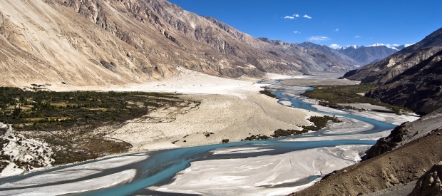
Welcome to the Google Earth KML "Water, Dams, and the Indus River." This is an interactive map that contains stories about water in the Indus River Basin, which, along with its five main tributaries, is shared by India, Pakistan, and China. The map covers the last 100 years of water in the Indus Basin in Pakistan — what has been done with water, where it goes, who decides what to do next, and how conflict and cooperation have shaped life on the river.
Download the Google Earth KML "Water, Dams, and the Indus River" now
Watch a YouTube video explaining how to use the KML layer here
This Google Earth KML is not like a book you read cover to cover. Instead, you can use the time scroller on the top left part of the screen to advance to a certain year, and then explore the items that appear on the map. Clicking on each item reveals a text box with stories, data, and links to sites with more detailed information. You can also use the scroller to play the map like a movie and watch how the Indus River has been developed over the past 100 years.
This Google Earth layer helps show how people's understanding of the Indus River has changed, and how those changes have physically impacted what happens on the river. At one time, seasonal changes determined how water could be used for irrigation. Now, big dams and big money decide where water goes -- or doesn't.
Like any story, there are gaps to fill. Normally, the only stories we hear are from those with the money and power to raise their voices above the rest. But now, in the age of the internet, anyone with access to a computer and a connection can contribute missing and unheard details. We can each tell the stories that can’t be told by one person alone -- the kinds of stories that require a conversation rather than a single narrative.
If you would like to add your own story to the map, you can email me at penny.beames@gmail.com. The map will be updated periodically to include submissions and enhance the story. This is only the beginning.
Border Disclaimer
The northern-most border between India and Pakistan is disputed and has been since the two countries were formed in 1947.
The dispute hinges on control over the Kashmir region. Both India and Pakistan claim rights over the region, and have fought multiple wars over who should control it.
The border illustrated in the KML after 1947 is the Line of Control. Though the Line of Control represents a de facto border between the two countries, it is not actually an internationally-recognized boundary.
The Line of Control separates Pakistan-administered Kashmir from Indian-administered Kashmir. The boundary is still in dispute.


